Styria is the largest Slovenian region. It is probably going to be divided into three parts ? new administrative regions. In that area, Styria is going to be divided into two parts, one at the Drava River ? Podravje or Gornja Štajerska (Upper Styria), and the other at the Savinja River ? Savinjska or Spodnja Štajerska (Lower Styria). Let?s take a look at Spodnja Štajerska for the beginning, also because we can reach Savinjska and then Gornja Štajerska over already mentioned passes Črnivec, Motnik, Trojane and Kanderše.
Gornja Štajerska (Upper Styria)
The main artery of Gornja Štajerska is the Drava River, which cut its path between Kozjak in the north, and Pohorje in the south. From Maribor onwards it flows through flat land, it has flown that way since long time before the first settlements were founded there. On the east, there is another big river of Styria, Mura, and on the south, it flows much smaller (except when it?s flooded) river Dravinja. An extensive area around Pohorje hills is named Pohorsko Podravje. Geologically, Pohorje is a part of the Central Alps, as it is almost entirely built of metamorphic and igneous rocks. Pohorje has the widest and the most rounded ridges of all alpine hills, and they migrate into narrow ravines at the end. Large group of mountains, more than 50 kilometers long, 25 kilometers wide and 1500 meters high, contains Črni vrh (1534 m), Velika kopa (1542 m) and Rogla (1517 m). Read more…
Zasavje
Administrative region of Zasavje is not considered as Spodnja Štajerska anymore (even less than Posavska), but it would be the right thing to mention it here. Especially because geographic area from west of Ljubljana Basin to the hills around the Sotla River is called Posavsko hribovje, recently also Vzhodno Predalpsko hribovje. The area contains almost 10% of the area of Slovenia, it is more than 25 kilometers wide and 70 kilometers long. Read more…
Spodnja Štajerska (Lower Styria)
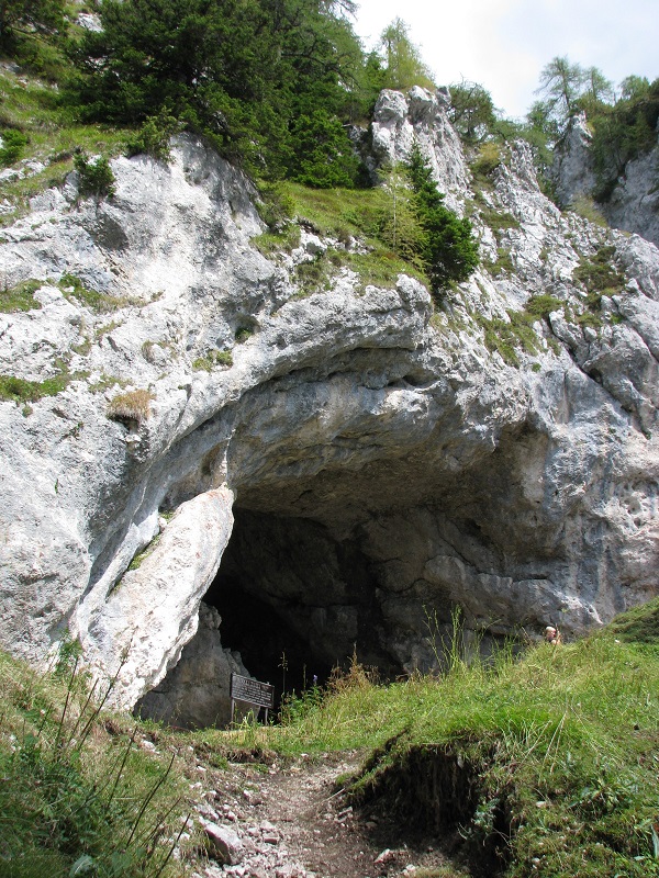
Also Spodnja Štajerska is divided into several parts. Zgornja Savinjska dolina with Logarska dolina valley is one of the most beautiful alpine valleys, and it starts in upper part of the Savinja River, at the source of the river, waterfall Rinka. Also Zadrečka dolina ob Dreti is a part of Zgornja Savinjska dolina. The highest mountains in this area are part of Kamnik-Savinja Alps (Planjava, Ojstrica), very famous are also Olševa mountain with Potočka zijalka and Velika Raduha (2062 m) with Snežna jama.
Two of the biggest settlements there are Solčava with gothic parish church of Saint Mary of the Snow and Gornji Grad by the Dreta River. This place was owned by patriarchs of Aquileia, which have also built Benedictine monastery in Gornji Grad in 12th century (in year 1140). It was later taken over by the Habsburgs and given to the newly founded archdiocese of Ljubljana in year 1461. Wide valleys by the rivers Savinja and Dreta are on the south side closed by plateaus Menina and Dobrovlje. Read more…
Table of Contents
Related articles
- Koroška (sloveniaholidays.org)
- Dolenjska and Novo mesto (sloveniaholidays.org)
- Gorenjska – Kranj, Kamnik (sloveniaholidays.org)
- Gorenjska – Radovljica, Škofja Loka (sloveniaholidays.org)


 Business tourism is a major part of tourism in the world.